Explore: Drone Aircraft In Remote Sensing
Discover books, insights, and more — all in one place.
Learn more about Drone Aircraft In Remote Sensing with top reads curated from trusted sources — all in one place.
AI-Generated Overview About “drone-aircraft-in-remote-sensing”:
Books Results
Source: The Open Library
The Open Library Search Results
Search results from The Open Library
1Drone Futures
By Paul Cureton
“Drone Futures” Metadata:
- Title: Drone Futures
- Author: Paul Cureton
- Language: English
- Number of Pages: Median: 256
- Publisher: Taylor & Francis Group
- Publish Date: 2020
“Drone Futures” Subjects and Themes:
- Subjects: ➤ Agriculture - Landscape design - Equipment and supplies - City planning - Drone aircraft in remote sensing - Télédétection par drone - ARCHITECTURE / Landscape - ARCHITECTURE / Urban & Land Use Planning
Edition Identifiers:
- The Open Library ID: ➤ OL28076364M - OL28076822M - OL28076387M - OL28076554M - OL28076826M - OL28076444M
- Online Computer Library Center (OCLC) ID: 1150789251
- Library of Congress Control Number (LCCN): 2020000955
- All ISBNs: ➤ 9781351212960 - 1351212966 - 0815380518 - 9781351212984 - 081538050X - 1351212990 - 9781351212977 - 9780815380504 - 9780815380511 - 9781351212991 - 1351212982 - 1351212974
Access and General Info:
- First Year Published: 2020
- Is Full Text Available: No
- Is The Book Public: No
- Access Status: No_ebook
Online Marketplaces
Find Drone Futures at online marketplaces:
- Amazon: Audiable, Kindle and printed editions.
- Ebay: New & used books.
2Unmanned Aerial Remote Sensing
By Green, David R.
“Unmanned Aerial Remote Sensing” Metadata:
- Title: Unmanned Aerial Remote Sensing
- Author: Green, David R.
- Language: English
- Number of Pages: Median: 256
- Publisher: Taylor & Francis Group
- Publish Date: 2020 - 2023
“Unmanned Aerial Remote Sensing” Subjects and Themes:
- Subjects: ➤ Environmental monitoring - Remote sensing - Environmental mapping - Drone aircraft in remote sensing - Environnement - Surveillance - Télédétection - Cartographie de l'environnement - Télédétection par drone - TECHNOLOGY - Engineering - Mechanical - Environmental Engineering & Technology - Remote Sensing
Edition Identifiers:
- The Open Library ID: ➤ OL28064911M - OL28065120M - OL28064992M - OL46068372M - OL29396598M - OL28065066M
- Online Computer Library Center (OCLC) ID: 1165387340
- All ISBNs: ➤ 0429529341 - 9781032474342 - 9780429172410 - 0429544049 - 9780429529344 - 1482246074 - 9781482246087 - 1032474343 - 9780429544040 - 1482246082 - 0429172419 - 9781482246070
Access and General Info:
- First Year Published: 2020
- Is Full Text Available: No
- Is The Book Public: No
- Access Status: No_ebook
Online Marketplaces
Find Unmanned Aerial Remote Sensing at online marketplaces:
- Amazon: Audiable, Kindle and printed editions.
- Ebay: New & used books.
3Fundamentals of Capturing and Processing Drone Imagery and Data
By Amy E. Frazier and Kunwar K. Singh
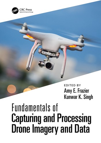
“Fundamentals of Capturing and Processing Drone Imagery and Data” Metadata:
- Title: ➤ Fundamentals of Capturing and Processing Drone Imagery and Data
- Authors: Amy E. FrazierKunwar K. Singh
- Language: English
- Number of Pages: Median: 361
- Publisher: Taylor & Francis Group
- Publish Date: 2021
“Fundamentals of Capturing and Processing Drone Imagery and Data” Subjects and Themes:
- Subjects: ➤ Aerial photography in geography - Environmental monitoring - Remote sensing - Earth sciences - Drone aircraft in remote sensing - Drone aircraft - Scientific applications - TECHNOLOGY / Environmental Engineering & Technology - TECHNOLOGY / Imaging Systems - TECHNOLOGY / Remote Sensing
Edition Identifiers:
- The Open Library ID: OL34705289M - OL33852749M - OL33852606M - OL33852599M
- Online Computer Library Center (OCLC) ID: 1251739522
- Library of Congress Control Number (LCCN): 2021021248
- All ISBNs: ➤ 9781000401950 - 1000401952 - 0429283237 - 9781000402049 - 0367245728 - 9780367245726 - 1000402045 - 9780429283239
Access and General Info:
- First Year Published: 2021
- Is Full Text Available: No
- Is The Book Public: No
- Access Status: No_ebook
Online Marketplaces
Find Fundamentals of Capturing and Processing Drone Imagery and Data at online marketplaces:
- Amazon: Audiable, Kindle and printed editions.
- Ebay: New & used books.
4Imaging and Sensing for Unmanned Aircraft Systems
By Vania V. Estrela, Jude Hemanth, Osamu Saotome, George Nikolakopoulos and Roberto Sabatini
“Imaging and Sensing for Unmanned Aircraft Systems” Metadata:
- Title: ➤ Imaging and Sensing for Unmanned Aircraft Systems
- Authors: Vania V. EstrelaJude HemanthOsamu SaotomeGeorge NikolakopoulosRoberto Sabatini
- Language: English
- Number of Pages: Median: 500
- Publisher: ➤ Institution of Engineering & Technology
- Publish Date: 2020
“Imaging and Sensing for Unmanned Aircraft Systems” Subjects and Themes:
- Subjects: ➤ Transportation - Drone aircraft - Drone aircraft in remote sensing - Imaging systems - Drones - Télédétection par drone - Imagerie (Technique) - Drone airplanes
Edition Identifiers:
- The Open Library ID: OL28085403M - OL35543196M - OL28085404M - OL35555109M
- Online Computer Library Center (OCLC) ID: 1156663665
- All ISBNs: ➤ 1785616447 - 1785616455 - 9781785616426 - 9781785616457 - 1785616439 - 9781785616433 - 9781785616440 - 1785616420
Access and General Info:
- First Year Published: 2020
- Is Full Text Available: No
- Is The Book Public: No
- Access Status: No_ebook
Online Marketplaces
Find Imaging and Sensing for Unmanned Aircraft Systems at online marketplaces:
- Amazon: Audiable, Kindle and printed editions.
- Ebay: New & used books.
5Introduzione all'utilizzo dei droni in archeologia
By Antonio Pecci
“Introduzione all'utilizzo dei droni in archeologia” Metadata:
- Title: ➤ Introduzione all'utilizzo dei droni in archeologia
- Author: Antonio Pecci
- Language: ita
- Number of Pages: Median: 187
- Publisher: Arbor sapientiae editore
- Publish Date: 2021
- Publish Location: Roma
“Introduzione all'utilizzo dei droni in archeologia” Subjects and Themes:
- Subjects: ➤ Aerial photography in archaeology - Drone aircraft in remote sensing - Archaeology - Technological innovations
Edition Identifiers:
- The Open Library ID: OL43736250M
- Online Computer Library Center (OCLC) ID: 1303268881
- All ISBNs: 8831341669 - 9788831341660
Access and General Info:
- First Year Published: 2021
- Is Full Text Available: No
- Is The Book Public: No
- Access Status: No_ebook
Online Marketplaces
Find Introduzione all'utilizzo dei droni in archeologia at online marketplaces:
- Amazon: Audiable, Kindle and printed editions.
- Ebay: New & used books.
Wiki
Source: Wikipedia
Wikipedia Results
Search Results from Wikipedia
Unmanned aerial vehicle
Monitoring". Remote Sensing. 10 (4): 641. Bibcode:2018RemS...10..641M. doi:10.3390/rs10040641. hdl:10251/127481. ISSN 2072-4292. "7.3. Sensing for Drones—Introduction
Unmanned combat aerial vehicle
and carries aircraft ordnance such as missiles, anti-tank guided missiles (ATGMs), and/or bombs in hardpoints for drone strikes. These drones are usually
Regulation of unmanned aerial vehicles
fly drones in the open category, for which there are three Remote Pilot licenses A1, A2 and A3. Drones can be used privately and commercially. In any
Uncrewed vehicle
control—remote controlled or remote guided vehicles—or they can be autonomously controlled—autonomous vehicles—which are capable of sensing their environment
General Atomics MQ-9 Reaper
Russian fighter aircraft intercepted a US Air Force MQ-9 over Syria and deployed flares in front of it, damaging the propeller. The drone returned to base
Autonomous aircraft
autonomous aircraft are unmanned aerial vehicles (drones) with pre-programmed algorithms to perform designated tasks, but advancements in artificial intelligence
High-altitude platform station
Remote Sensing (ACRS). The Joint Center for Remote Sensing of CAS China. "NASA Recruits Unmanned Aircraft for Earth Science". Space.com. January 17, 2009
Unmanned aircraft system traffic management
partnership takes to the skies in UK-first to fly drones safely in controlled airspace". sUAS News - The Business of Drones. Retrieved 2020-06-26. Wright
Weather drone
A weather drone, or weather-sensing uncrewed aerial vehicle (UAV), is a remotely piloted aircraft weighing less than 25 kg and carrying sensors that collect
DJI Mini
Vision Sensing collision avoidance system, which uses four fisheye and two downward binocular vision sensors and a time-of-flight sensor. The drone also